Resources
Vegetation Encroachment and Clearance
Resources
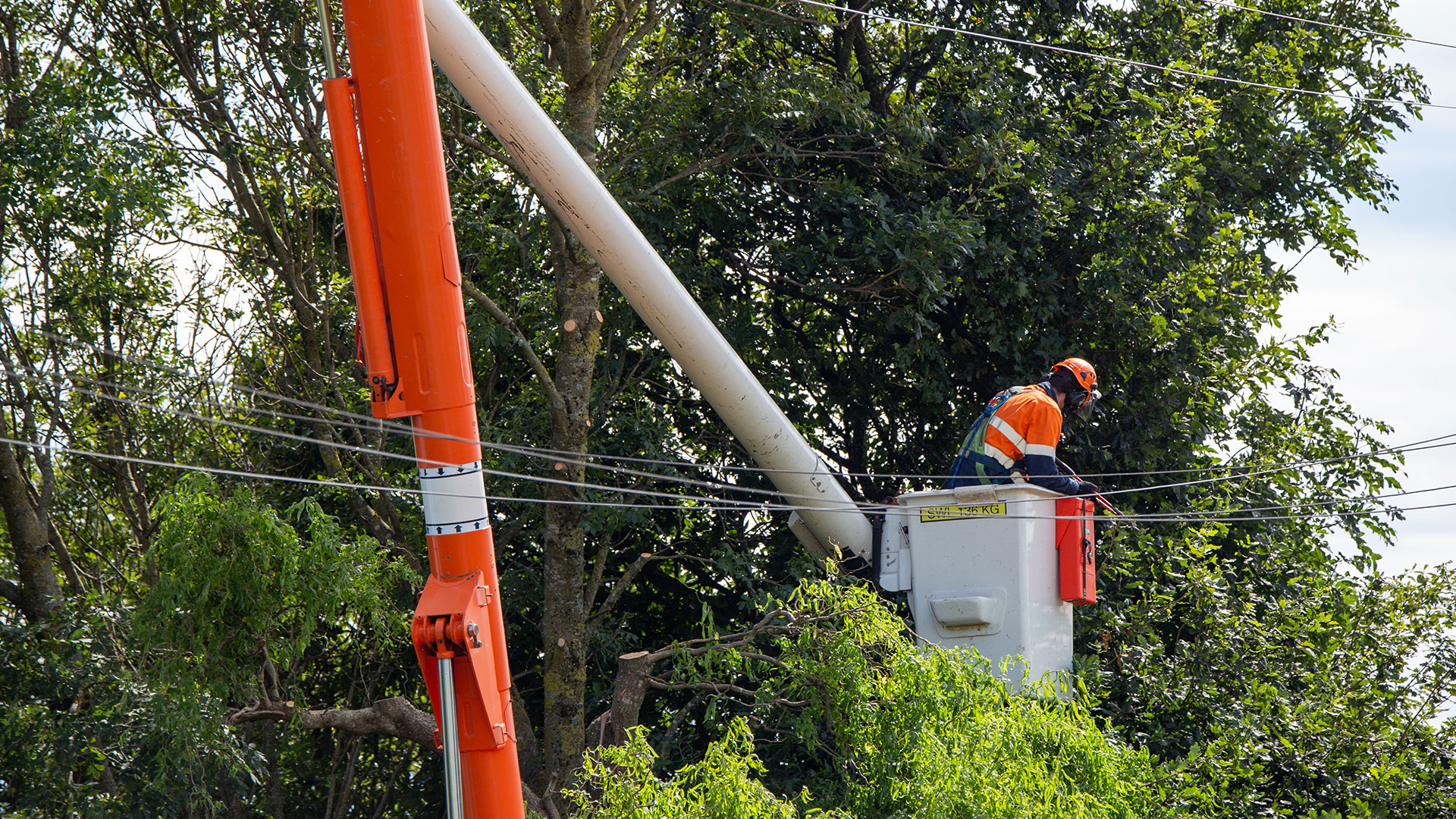
Vegetation Encroachment and Clearance
Grid analysis and management with Neara
At a glance
- Neara enables customized vegetation and ground clearance analysis, 3D visualization, prioritization, risk analysis, and cost analysis in a single integrated platform.
- Vegetation treatment can be prioritized based on custom risk exposure, cost, and consequence-of-failure formulas.
- Utilities have total control over current and future iterations of vegetation management policies, adapting as more information is collected and priorities change.
- One large Australian utility saved ~3000 site visits by performing digital
- inspections. Another is reviewing network-wide encroachment zones by comparing inter-year LiDAR scans and power failure data.
An electricity network’s primary objective is to provide a high and consistent quality of power to its customers, at an acceptable price, while minimizing the physical danger and general inconvenience caused by the network. Leading utilities correctly balance and manage divergent priorities that include high quality of service, sensible spending, and risk minimization.
For most utility networks, vegetation management plays a critical role. It is often the most expensive component of network maintenance, and most consequential in terms of network risk, public safety, and service delivery.
Neara takes a systematic, process-driven approach to vegetation management, in which identification of encroachment is only the first step.
5 Steps of Holistic Vegetation Management
We see comprehensive vegetation management as comprising these five steps:
- Compilation of data inputs and construction of a utility network digital twin
- Identification of current and future encroachment risk
- Criticality, risk, prioritization, cost
- Operationalizing and actioning
- Confirmation, monitoring, reiteration
All five can be achieved using the Neara Platform and expanded by working with integrated software modules of Neara’s partners.
1. Compilation of data inputs and construction of a utility network digital twin
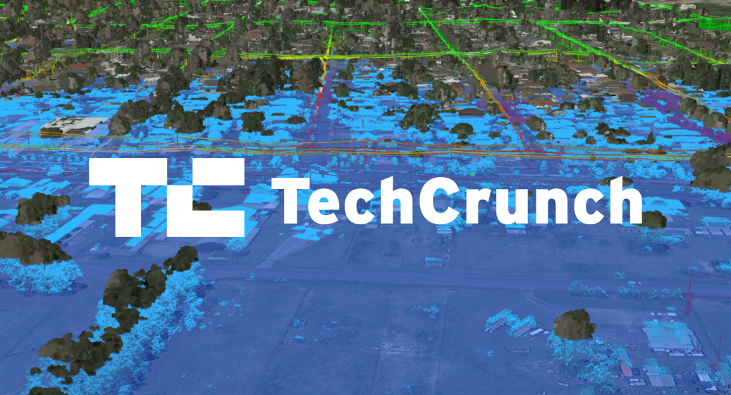
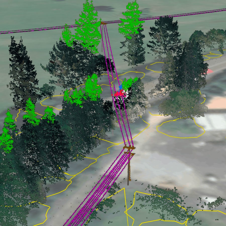
To facilitate ongoing, accurate vegetation management, the first step is to build a whole-of-network, engineering-grade digital twin within the Neara Platform. Neara automatically constructs and precisely fits this model using LiDAR and existing network GIS information.
Utilities may draw upon Neara’s Spatial modules to efficiently classify raw LiDAR data, and Neara’s Analyze modules to intelligently correct and provide exception reports for poorly located GIS, and missing poles and circuits. The result is an accurate and verified 3D digital twin of the utility’s network, which brings compounding benefits to any use cases and analytics performed down the line.
2. Identification of encroachment risk, both current and future
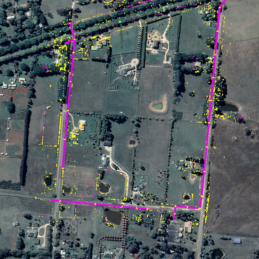
Neara can analyze encroachment at varying levels of sophistication. At its most preliminary, utilities can define encroachment radial and boxed zones around static lines, altering the results according to voltage, conductor length and type, and region.
For utilities interested in going beyond conventional encroachment detection techniques, Neara offers more advanced capabilities, including:
- Sag, blowout, and pole-deflection under any environmental or loading scenarios
- Predictive growth modeling using integrated software of Neara’s partners
- Fall-in-risk tree and branch rotation simulations
- Integration of photographs, and satellite imagery to better understand proximate tree health and probability of fall
All this is visualized live within Neara, allowing utilities to test and sample different vegetation management policies and immediately see the implications for maintenance plans and overall cost.
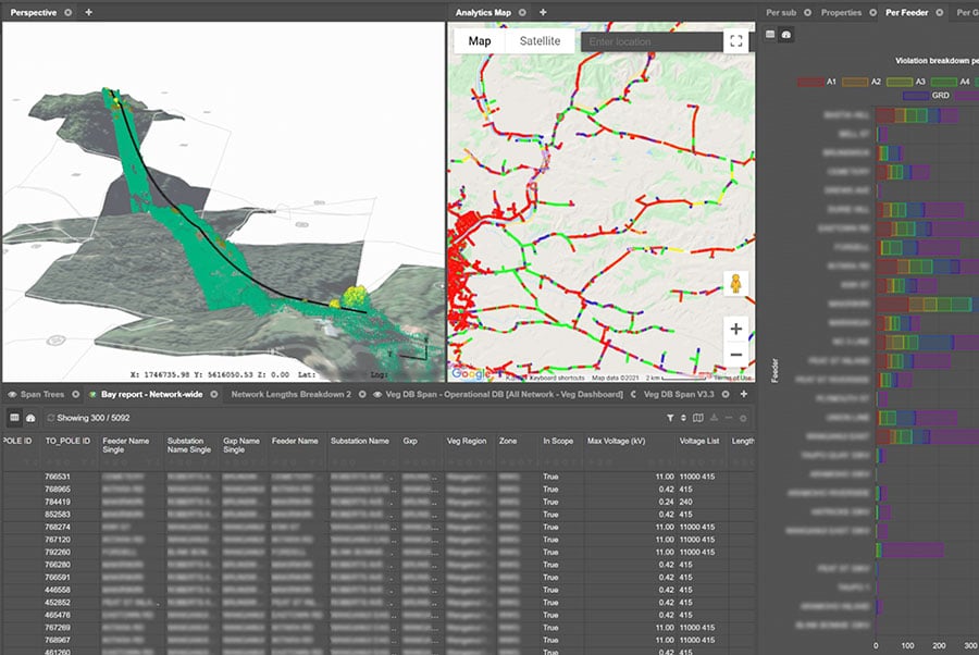
3. Criticality, risk, prioritization, cost
Identifying vegetation encroachments is less than half the story. Utilities looking to intelligently address encroachment issues want to understand which encroachments matter, which don’t, and what the priority order should be. Neara Analytics allows utilities to do this in a systematic, auditable, iterative fashion.
This is particularly important in the US market, given that the North American Electric Reliability Corporation (NERC) closely monitors the standards of US electric utilities.
After locating vegetation encroachments and criticality of network components, the potential risks can be established by uploading and overlaying environmental and network datasets, including:
- Geographic information in the region of interest, historic weather data, wild-fire zones, land-use maps, etc.
- Network asset information, voltages, conductor types, down-the-line feeder dependencies, customers and locations of critical importance, etc.
These indicators of a given network asset’s criticality and risk potential are weighted, resulting in a whole-of-network risk and criticality weighting map. This can then be overlaid with job cost information, enabling utilities to unlock a network-wide, rules-based, and fully auditable risk-cost-payoff heatmap.
For network operators, available budgets can now be optimally allocated to address the most critical and highest risk issues first.
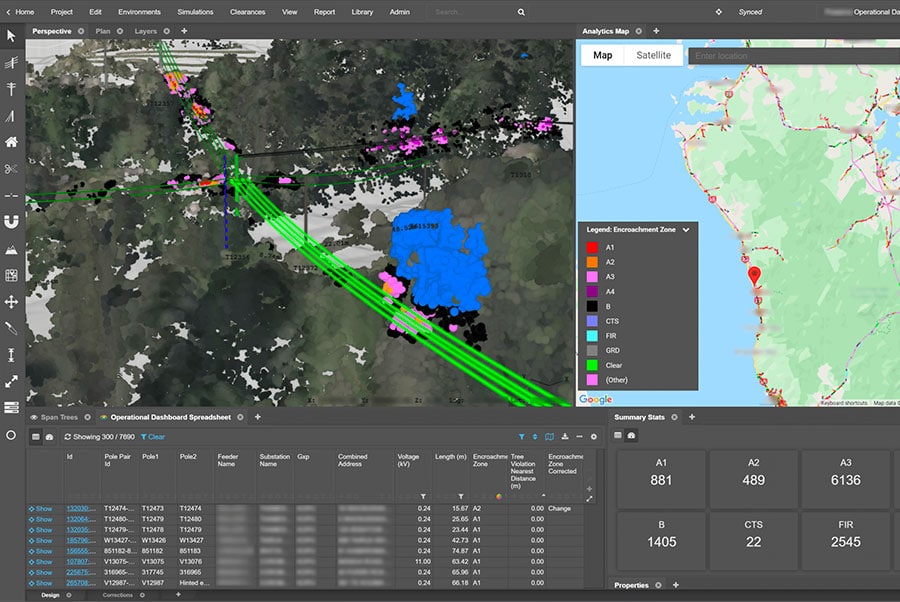
4. Operationalization and actioning
Within the one platform, utilities can build custom dashboards for operational contractors (internal and external) to receive cutting instructions, scope their work, and understand the situation before inspecting. Neara can also be used offline (and in the field) through Neara’s field mobile tool. The result is a more surgical and intentional tree-by-tree trimming operation, ensuring that only the vegetation that poses a true danger is cleared.
5. Confirmation, monitoring, reiteration
Neara enables utilities to compare before-and-after network scans on a network-wide scale. This allows utilities to confirm that work was correctly and adequately completed, examine regrowth characteristics, and fine-tune cutting schedules.
As more data from scans, satellite imagery, and network incidents are fed into Neara, network operators can leverage it to tweak and improve vegetation management policies.
Vegetation management is something that should grow with the network, getting more precise and reliable as time goes on. Neara provides a comprehensive suite of tools to do just that.
Discover how Neara’s solutions can bring you closer to your assets, environment, and business. Request a demo or email us at info@neara.com.
Reach out. We’re very friendly.
Contact us to learn more, schedule a demo, inquire about a pilot project, or discuss other needs.